

Select Category
_0x200.jpg)

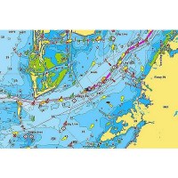
Garmin 010C111400 Lakevu G3 Ultra Chart, Canada - 010-C1114-00 - 322-010C111400F1
Experience unparalleled coverage and brilliant detail on the water. LakeVü g3 Ultra inland water maps provide industry-leading coverage, clarity and detail with integrated Garmin and Navionics data, Auto Guidance technology and high-resolution relief shading. Provides industry-leading coverage, clarity and detail for more than 13,500 lakes with 1' contours that feature integrated Garmin and Navionics® dataAuto Guidance technology uses your desired depth and overhead clearance to calculate routes and show a suggested path to followHigh-resolution relief shading combines color and shadow to give you an easy-to-interpret, clearer view of bottom structure than contour lines aloneCovers more than 13,500 HD lakes with up to 1' contours
Garmin 010C120400 Lakevu G3 Ultra Chart, U.S. East - 010-C1204-00 - 322-010C120400F1
Experience unparalleled coverage and brilliant detail on the water. LakeVü g3 Ultra inland water maps provide industry-leading coverage, clarity and detail with integrated Garmin and Navionics data, Auto Guidance technology and high-resolution relief shading. Provides industry-leading coverage, clarity and detail for more than 11,500 lakes with 1' contours that feature integrated Garmin and Navionics® dataAuto Guidance technology uses your desired depth and overhead clearance to calculate routes and show a suggested path to followHigh-resolution relief shading combines color and shadow to give you an easy-to-interpret, clearer view of bottom structure than contour lines aloneCovers more than 11,500 HD lakes with up to 1' contours, and more than 100 Garmin Elite survey lakes
Garmin 010C120500 Lakevu G3 Ultra Chart, U.S. West - 010-C1205-00 - 322-010C120500F1
Experience unparalleled coverage and brilliant detail on the water. LakeVü g3 Ultra inland water maps provide industry-leading coverage, clarity and detail with integrated Garmin and Navionics data, Auto Guidance technology and high-resolution relief shading. Provides industry-leading coverage, clarity and detail for more than 5,900 lakes with 1' contours that feature integrated Garmin and Navionics® dataAuto Guidance technology uses your desired depth and overhead clearance to calculate routes and show a suggested path to followHigh-resolution relief shading combines color and shadow to give you an easy-to-interpret, clearer view of bottom structure than contour lines aloneCovers more than 5,900 HD lakes with up to 1' contours, and more than 75 Garmin Elite survey lakes
Garmin 010C128720 Navionics+™ Chart, U.S. & Coastal Canada - 010-C1287-20 - 322-010C128720F1
PLOT YOUR PARADISE - with the best, most up-to-date Garmin Navionics+™ marine cartography on your compatible Garmin chartplotter. For offshore or inland waters, get detail-rich integrated mapping, shaded depth contours, advanced Auto Guidance+™ technology and access to daily updates via the ActiveCaptain app. Card type SD/MSD.For Garmin Chartplotters Only. Some features require subscription. See Navionics website for compatibility, coverage details & full list of features.
Garmin 010C128820 Navionics+™ Chart, Canada & Alaska - 010-C1288-20 - 322-010C128820F1
PLOT YOUR PARADISE - with the best, most up-to-date Garmin Navionics+™ marine cartography on your compatible Garmin chartplotter. For offshore or inland waters, get detail-rich integrated mapping, shaded depth contours, advanced Auto Guidance+™ technology and access to daily updates via the ActiveCaptain app. Card type SD/MSD.For Garmin Chartplotters Only. Some features require subscription. See Navionics website for compatibility, coverage details & full list of features.

Garmin 010C128900 Navionics Vision+™ For Garmin, U.S. North - 010-C1289-00 - 322-010C128900F1
PLOT YOUR PARADISE - with the best, most up-to-date Garmin Navionics Vision+™ premium marine cartography on your compatible Garmin chartplotter. For offshore or inland waters, get premier-grade chart features, including detail-rich integrated mapping, high-resolution relief shading, 3D views, satellite imagery, advanced Auto Guidance+™ technology and access to daily updates via the ActiveCaptain® app. Card type SD/MSD.For Garmin Chartplotters Only. Some features require subscription. See Navionics website for compatibility, coverage details & full list of features.
Garmin 010C128920 Navionics+™ Chart, U.S. North - 010-C1289-20 - 322-010C128920F1
PLOT YOUR PARADISE - with the best, most up-to-date Garmin Navionics+™ marine cartography on your compatible Garmin chartplotter. For offshore or inland waters, get detail-rich integrated mapping, shaded depth contours, advanced Auto Guidance+™ technology and access to daily updates via the ActiveCaptain app. Card type SD/MSD.For Garmin Chartplotters Only. Some features require subscription. See Navionics website for compatibility, coverage details & full list of features.
Garmin 010C129000 Navionics Vision+™ For Garmin, U.S. South - 010-C1290-00 - 322-010C129000F1
PLOT YOUR PARADISE - with the best, most up-to-date Garmin Navionics Vision+™ premium marine cartography on your compatible Garmin chartplotter. For offshore or inland waters, get premier-grade chart features, including detail-rich integrated mapping, high-resolution relief shading, 3D views, satellite imagery, advanced Auto Guidance+™ technology and access to daily updates via the ActiveCaptain® app. Card type SD/MSD.For Garmin Chartplotters Only. Some features require subscription. See Navionics website for compatibility, coverage details & full list of features.
Garmin 010C129020 Navionics+™ Chart, U.S. South - 010-C1290-20 - 322-010C129020F1
PLOT YOUR PARADISE - with the best, most up-to-date Garmin Navionics+™ marine cartography on your compatible Garmin chartplotter. For offshore or inland waters, get detail-rich integrated mapping, shaded depth contours, advanced Auto Guidance+™ technology and access to daily updates via the ActiveCaptain app. Card type SD/MSD.For Garmin Chartplotters Only. Some features require subscription. See Navionics website for compatibility, coverage details & full list of features.
Garmin 010C129100 Navionics Vision+™ For Garmin, U.S. East - 010-C1291-00 - 322-010C129100F1
PLOT YOUR PARADISE - with the best, most up-to-date Garmin Navionics Vision+™ premium marine cartography on your compatible Garmin chartplotter. For offshore or inland waters, get premier-grade chart features, including detail-rich integrated mapping, high-resolution relief shading, 3D views, satellite imagery, advanced Auto Guidance+™ technology and access to daily updates via the ActiveCaptain® app. Card type SD/MSD.For Garmin Chartplotters Only. Some features require subscription. See Navionics website for compatibility, coverage details & full list of features.
Garmin 010C129120 Navionics+™ Chart, U.S. East - 010-C1291-20 - 322-010C129120F1
PLOT YOUR PARADISE - with the best, most up-to-date Garmin Navionics+™ marine cartography on your compatible Garmin chartplotter. For offshore or inland waters, get detail-rich integrated mapping, shaded depth contours, advanced Auto Guidance+™ technology and access to daily updates via the ActiveCaptain app. Card type SD/MSD.For Garmin Chartplotters Only. Some features require subscription. See Navionics website for compatibility, coverage details & full list of features.
Garmin 010C129200 Navionics Vision+™ For Garmin, U.S. West - 010-C1292-00 - 322-010C129200F1
PLOT YOUR PARADISE - with the best, most up-to-date Garmin Navionics Vision+™ premium marine cartography on your compatible Garmin chartplotter. For offshore or inland waters, get premier-grade chart features, including detail-rich integrated mapping, high-resolution relief shading, 3D views, satellite imagery, advanced Auto Guidance+™ technology and access to daily updates via the ActiveCaptain® app. Card type SD/MSD.For Garmin Chartplotters Only. Some features require subscription. See Navionics website for compatibility, coverage details & full list of features.
Garmin 010C129220 Navionics+™ Chart, U.S. West - 010-C1292-20 - 322-010C129220F1
PLOT YOUR PARADISE - with the best, most up-to-date Garmin Navionics+™ marine cartography on your compatible Garmin chartplotter. For offshore or inland waters, get detail-rich integrated mapping, shaded depth contours, advanced Auto Guidance+™ technology and access to daily updates via the ActiveCaptain app. Card type SD/MSD.For Garmin Chartplotters Only. Some features require subscription. See Navionics website for compatibility, coverage details & full list of features.
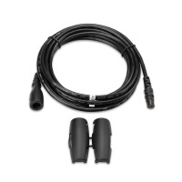
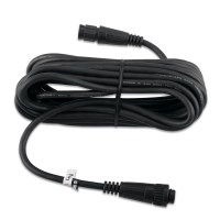
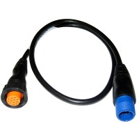
Garmin 4-Pin Female to 5-Pin Male NMEA 2000® Adapter Cable f/echoMAP™ CHIRP 5Xdv
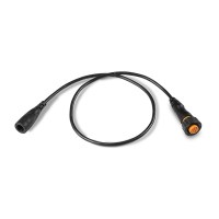
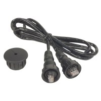

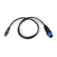
Garmin 8-Pin Female to Wire Block Adapter f/echoMAP™ 50s & 70s, GPSMAP® 4xx, 5xx & 7xx, GSD™& 24

Garmin 8616 Gpsmap® 8600 Gps Chartplotter W/Touchscreen - 010-02093-50 - 322-0100209350F1
Get wider viewing angles and superior clarity on the touchscreen with a full HD in-plane switching (IPS) displayNavigate confidently with built-in Garmin Navionics+™ inland and coastal mappingEasily build your marine system using the best of network connectivityFrom ANT® technology to Wi-Fi® networking, there are countless ways to connect to your systemSmartMode™ station controls, everything is designed to give you quick, one-touch access to the information you needInstall multiple displays, either flat mounted edge-to-edge for a sleek glass helm look or mounted flush - creating a stunning helmOptional, easy-to-use GRID 20 remote input device provides intuitive remote access and control of your entire Garmin marine systemPair your chartplotter with Garmin live sonar options (transducer sold separately) to see all around your boat in real timeUnparalleled coverage and detail with built-in Garmin Navionics+™ integrated coastal and inland mapping that includes Auto Guidance+™ technology3 and a 1-year subscription for downloadable daily updates and more on select chartplottersSailassistT™ Sailing features View laylines, race start line guidance, enhanced wind rose, heading and course-over-ground lines, true wind data fields and tide/current/time slider, wind angle, set and drift, wind speed, polars and moreSailing Polars, use the polar table to see key data, including how fast you should go at a certain wind angle and speed - so you know whether you need to adjust sail trim In The Box: GPSMAP unit, Power cable, NMEA 2000® drop cable, NMEA 2000 T-connector, Flush mount kit, Sun cover, Trim piece snap covers.


Garmin Adjustable Perspective Bottom Mount for LiveScope™ Transducers
Garmin Adjustable Perspective Shaft Mount for LiveScope™ Transducers
Garmin Airmar 509LHW 3kW 28 to 60kHz & 150 to 250kHz Thru-Hull Transducer
Garmin Airmar B175H 12° Tilt, 1kW CHIRP High, 130-210kHz Thru-Hull Transducer w/Temp - 8 Pin
Garmin Airmar CM599LHW 1-3kW Pocket Mounted Transducer, 28-60 & 150-250kHz
Garmin Airmar R109LM Thru-Hull Transducer - Bare Wires
Garmin Airmar R111LH 2kW In-Hull Transducer, CHIRP Low (38-75kHz) & CHIRP High (130-210kHz)
Garmin Airmar Smart Sensor Depth & temperature 20 Degree Tilted NMEA 2000 DT800
Garmin Airmar SS502 Stainless Steel Depth & Temp 600W, 50/200kHz Transducer - 8 Pin
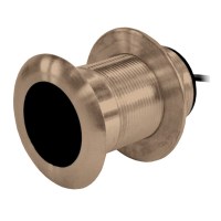
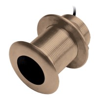
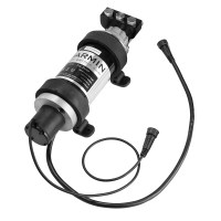
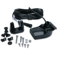
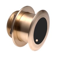
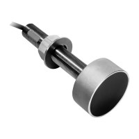
Garmin B117 Bronze Thru-Hull Mount Transducer W/0° Tilt & Temp - 010-10182-21 - 322-0101018221F1
This bronze thru-hull mount transducer performs well at high speeds. An excellent choice for fiberglass and wood hulls, this 8-pin 600W narrow stem transducer has a depth of 800' - 1,200'; an operating frequency of 50 - 200 kHz; a beamwidth of 45° to 12°; and a 0° to 7° deadrise. Transducer kit comes with installation instructions. Follow the instructions carefully to avoid damaging your boat.Do not use on metal hulls.