

Select Category
_0x200.jpg)
Screen/Frame Assy White Bell Rv Replaces P/N 312-Bvc05734104 - Bvc0573-41 - 312-Bvc057341F1
Screen/Frame Assy Birch Bell Rv Replaces P/N 312-Bvc05733104 - Bvc0573-31 - 312-Bvc057331F1
Screen/Frame Asm White W/Swtch Bell Rv Replaces P/N 312-Bvc057341R04 - Bvc0573-41R - 312-Bvc057341Rf1
Screen/Frame Asm Birch W/Swtch Bell Rv Replaces P/N 312-Bvc057331R04 - Bvc0573-31R - 312-Bvc057331Rf1

Screen Patch - 8150 - 147-8150F1
Ideal repair for nylon, metal or fiberglass screen in trailers, tents, windows and doors. Easy to use pressure sensitive Mylar. Each package contains 3 each 5 x 6-1/2" pieces. Carded.

Screen Kleen Kit Bell Rv Nods Rvx - M02303 - 246-M02303F1
Screen Fuel Fltr 75-600Hp 4Str - 8M0090809 - 710-35-8M0090809F1
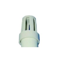
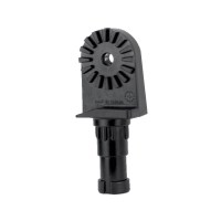
Screen For Odt1 & Odt190 - Odts1Dp - 232-Odts1Dpf1
These overflow drain tubes feature a tough, flexible vinyl plastic end with a standpipe of white PVC tubing. To use simply insert vinyl end into the opening of thru-hull fitting. To drain livewell or baitwell, simply remove. Can be cut to customer's lengths.
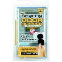
Screen Door Opener Replaces P/N 117-43953 Rvx - 43953 - 17-43953F1
Screen Door Handle Brown Valterra Dometic Disc - A77026 - 800-A77026F1

Screen Door Handle Black Valterra Dometic Rvx - A77025 - 800-A77025F1
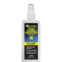
Screen Cleaner With Ptef, 8 Oz. - 88308 - 74-88308F1
Formulated for use on all marine electronics and all plastics. Easy to use, spray on, wipe up excess to remove fingerprints, smudges, salt deposits. PTEF polymers help protect against UV damage. It is Ideal for use on watertight phone cases. Will not affect touchscreen performance.
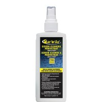
Screen Cleaner With Ptef, 8 Oz. - 088308C - 74-88308Cf1
Formulated for use on all marine electronics and all plastics. Easy to use, spray on, wipe up excess to remove fingerprints, smudges, salt deposits. PTEF polymers help protect against UV damage. It is Ideal for use on watertight phone cases. Will not affect touchscreen performance.
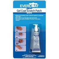
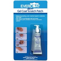
Scratch Patch White 1/2 Fl. Oz. - 105652 - 75-105652F1
Makes easy, permanent, color-matched repairs on hairline cracks, small scratches and chips in gel coat without sanding or using catalyst. Blend for match. Use resin colorant to tint white scratch patch for close match. Repair fiberglass boats, autos, bathtubs, shower stalls and hot tubs. Works on any gel-coated surface. Just clean surface, apply, smooth with plastic tool included, let semi-dry then remove excess. After final drying, wax to smooth into surrounding area. Includes 1/2 fl. oz. liquid patch material, applicator and instructions.
Scratch Patch Buff White 1/2 Fl. Oz. - 105653 - 75-105653F1
Makes easy, permanent, color-matched repairs on hairline cracks, small scratches and chips in gel coat without sanding or using catalyst. Blend for match. Use resin colorant to tint white scratch patch for close match. Repair fiberglass boats, autos, bathtubs, shower stalls and hot tubs. Works on any gel-coated surface. Just clean surface, apply, smooth with plastic tool included, let semi-dry then remove excess. After final drying, wax to smooth into surrounding area. Includes 1/2 fl. oz. liquid patch material, applicator and instructions.
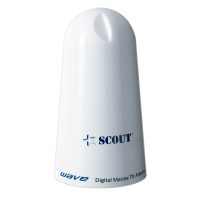
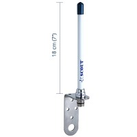
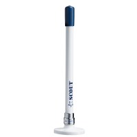
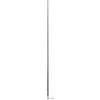
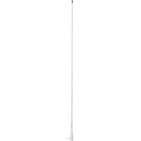
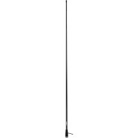
Scout Wave 4" White TV Antenna Omnidirectional 25dB Gain w/10M, 75 ohms, Cable

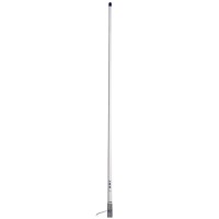

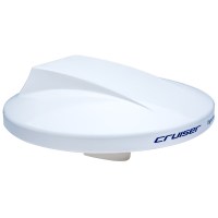
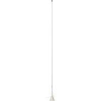
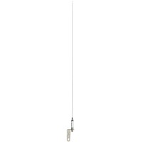
Scout Cruiser 10" White TV Antenna Omnidirectional w/20M, 75 ohms, Cable
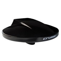
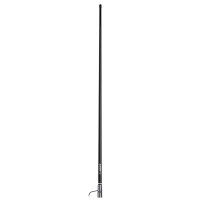
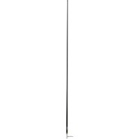
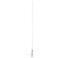
Scout Cruiser 10" Black TV Antenna Omnidirectional w/20M, 75 ohms, Cable


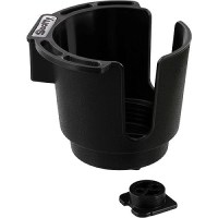
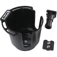
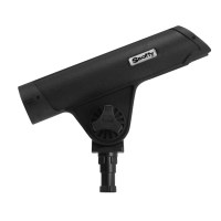
Scotty Xxx Drink Holder W/Bulkhead/Gunnel Mt., Black, 12/Case - 0310-Bk - 736-310Sf1
For cans, coffee mugs and insulated sleeves. Easily removable, convenient accessory rack to hang lures and tools. Use the Bulkhead / Gunnel Mount to attach the Cup Holder horizontally or vertically.
Scotty Xxx Drink Holder W/Bulkhaed/Gunnel/Rod Holder Mt., Black, 12/Case - 0311-Bk - 736-311Bkf1
For cans, coffee mugs and insulated sleeves. Easily removable, convenient accessory rack to hang lures and tools. Use the Bulkhead / Gunnel Mount to attach the Cup Holder horizontally or vertically. Also fits Scotty rod holder mounts.

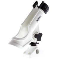
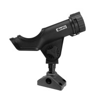
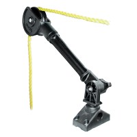
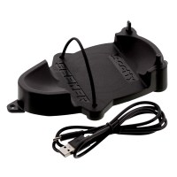
Scotty Universal Sounder/Fishfinder Mount - 368 - 736-368F1
The Scotty Universal Sounder/Fishfinder Mount uses a new multi pattern universal top plate and the patented Scotty post mount design for quick removal and adjustable rotation Simply fasten your sounder bracket to the top plate, then lock down the sounder mount into your favorite Scotty post mounting systemOnly intended for use with Fishfinders and other marine electronics

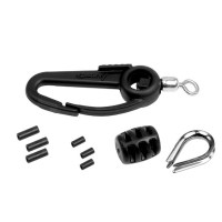
Scotty Star Knobfor Rod Holder Pmg - S-Stkn516X134 - 736-Sstkn516X134F1
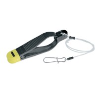
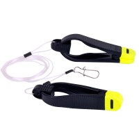
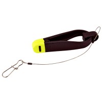
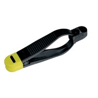
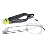
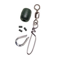
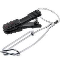
Scotty Snapper Release - Leader w/Stacking & Self-Locating Snap
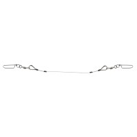
Scotty Snapper Release - 18" Leader w/Stacking & Self-Locating Snap
Scotty Shndlpump Replacement Handle Only - S-Hndlpump - 736-Shndlpumpf1
Handle Only

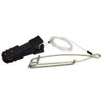
Scotty Seeker™ Full Package - Single Probe w/Safety Leader, Probe Charging Station, & Probe Safety Leader
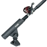
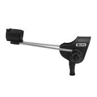
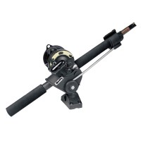
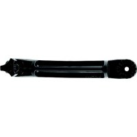
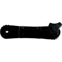
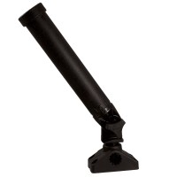
Scotty Rodmaster II Rod Holder w/241 Deck/Side Mount - Black
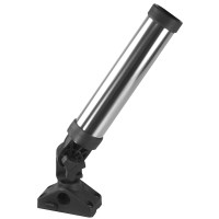
Scotty Rod Holder Extender, 6-1/2" - 459 - 736-0459F1
Provides the option for you to position your Scotty Rod Holder into that perfect fishing fighting location Conveniently position your rod holder closer to you on your kayak or your downrigger to eliminate reaching for your rodCan be used in conjunction with any previous Scotty downrigger boom mounted rod holder to bring the fish fighting action closer to youExtends the height of the rod holder by 6-1/2"Includes a star knob bolt
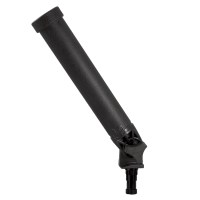
Scotty Rod Holder Extender, 5-1/2" - 0459M - 736-459Smf1
Provides the option for you to position your Scotty Rod Holder into that perfect fishing fighting location Conveniently position your rod holder closer to you on your kayak or your downrigger to eliminate reaching for your rodCan be used in conjunction with any previous Scotty downrigger boom mounted rod holder to bring the fish fighting action closer to youExtends the height of the rod holder by 5-1/2"Includes a star knob bolt
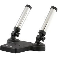
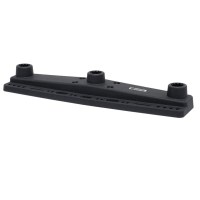
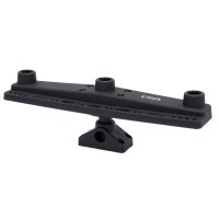
Scotty Rocket Launcher Dual Rod Holder - 447 - 736-447F1
Two fully adjustable Rocket Launcher Rod Holders with 9" of stainless steel jacketed composite construction. To be paired with the Scotty 1026 Downrigger Swivel Base and 1023 Tilt-up Mounting Bracket (both not included).
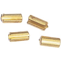
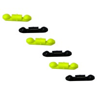
Scotty Release Clip Locators, 10/Pk - 1007 - 736-1007F1
Release Clip Locators
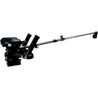
Scotty Propack 1116 Depthpower 30"-60" Telescopting Electric Downrigger W/Swivel Mt. - 1116 - 736-1116F1
Fully adjustable decent speed, lifts 7 lb. weights at 235 ft./min.; 15 lb. weights at 203 ft./min. Spray protected positive-drive depth counter and Kevlar drive belt250' of 150 lb. test, stainless steel downrigger cable2 10" Tube style rod holdersIncludes Scotty/Marinco™ plug and receptacleThe lowest amperage draw - less than 1/3 than some of the competitionMarine grade stainless steel boom1148 weight storage hookMulti-position auto-stop included (Use 1008 Stopper Beads)Includes 2 Power Grip Plus line releaseIncludes 1023 tilt-up mounting bracketIncludes 1026 swivel mountLimited lifetime warranty